

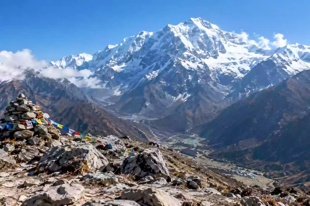
Langtang Kyanjin Ri Hiking is one of the most rewarding day hikes in Nepal’s Langtang Valley. From Kyanjin Gompa, the trail climbs steeply to Kyanjin Ri at about 4,773 metres, offering wide views of Langtang Lirung, surrounding Himalayan peaks, glaciers, and the upper Langtang Valley.
The hike is short compared with a full Himalayan trek, but it should not be underestimated. The combination of steep climbing, rocky terrain and high altitude makes Kyanjin Ri a challenging day hike for many trekkers.
The climb is normally done after reaching Kyanjin Gompa on the Langtang Valley Trek. Spending adequate time at altitude before attempting the summit is important, especially because Kyanjin Gompa itself sits at around 3,870 metres.
2026 access note: The Rasuwa/Langtang area experienced serious flooding in August 2026, affecting roads and infrastructure around the Syabrubesi approach. Trail conditions and road access should be confirmed locally before travelling.
Kyanjin Ri Hiking at a Glance
| Trek Fact | Details |
|---|---|
| Location | Langtang Valley, Nepal |
| Starting Point | Kyanjin Gompa |
| Kyanjin Gompa Altitude | About 3,870 m |
| Kyanjin Ri Altitude | About 4,773 m |
| Elevation Gain | About 900 m |
| Hiking Time | Around 3–5 hours round trip |
| Difficulty | Moderate to challenging |
| Trail Type | Steep, rocky mountain trail |
| Technical Climbing | Not normally required |
| Best Seasons | March–May and October–November |
| Main Attraction | Himalayan panorama and upper Langtang Valley views |
Kyanjin Ri is considerably shorter than a major trekking route, but the altitude gain makes it more demanding than the distance suggests. Recent route descriptions put the round trip at roughly 3–5 hours, although individual times vary with acclimatization, fitness, weather and trail conditions.
Where Is Kyanjin Ri and How Do You Reach It?
Kyanjin Ri is located directly above Kyanjin Gompa, the final major settlement on the classic Langtang Valley route.
Most trekkers first travel by road from Kathmandu toward Syabrubesi and then walk through the Langtang Valley. The route passes through forests, Tamang villages, alpine landscapes and yak pasture before reaching Kyanjin Gompa.
From Kyanjin Gompa, the Kyanjin Ri trail climbs directly up the mountainside. This makes the hike particularly convenient because you do not need to change accommodation or carry your main trekking luggage.
For a broader understanding of the region, see our Langtang Himal Trekking guide.
Typical approach
Kathmandu → Syabrubesi → Lama Hotel → Langtang Village → Kyanjin Gompa → Kyanjin Ri
The exact itinerary can vary depending on road conditions, walking pace and acclimatization requirements.
How Difficult Is Langtang Kyanjin Ri Hiking?
Langtang Kyanjin Ri Hiking is moderate to challenging, mainly because of altitude rather than technical climbing.
The trail gains approximately 900 metres from Kyanjin Gompa to the summit. Much of that elevation is gained over a relatively short distance, so the climb becomes increasingly steep.
You should expect:
- Steep uphill sections
- Rocky and uneven ground
- Thin air above 4,000 metres
- Frequent rest stops
- Strong sun exposure
- Cold and wind near the summit
- Rapidly changing mountain weather
You do not normally need ropes, climbing equipment or technical mountaineering skills. However, good physical preparation and previous experience with long uphill walks are useful.
A common mistake is judging the hike by its distance alone. A 5-kilometre mountain hike at almost 5,000 metres can be substantially harder than a much longer walk at low altitude.
Kyanjin Ri Altitude and Acclimatization
Altitude is the most important factor to consider before attempting Kyanjin Ri.
| Location | Approx. Altitude |
|---|---|
| Syabrubesi | 1,500 m |
| Langtang Village | 3,430 m |
| Kyanjin Gompa | 3,870 m |
| Kyanjin Ri | 4,773 m |
The jump from Kyanjin Gompa to Kyanjin Ri is approximately 900 metres. Therefore, attempting the hike immediately after arriving at Kyanjin Gompa is not a good strategy.
Give your body time to adjust
A sensible Langtang itinerary allows time around Kyanjin Gompa before a high viewpoint hike. Many trekkers spend an additional night there and use the day for acclimatization and shorter exploration before attempting Kyanjin Ri.
Watch for symptoms such as:
- Headache
- Unusual dizziness
- Nausea
- Loss of appetite
- Unusual tiredness
- Poor coordination
- Increasing shortness of breath
Do not continue climbing if symptoms are getting worse. At altitude, turning around is a sensible safety decision, not a failure.
For more general preparation, our trekking in Nepal guide can help you understand preparation, guides, and trekking logistics.
Acclimatization tip: Sleep at Kyanjin Gompa before attempting Kyanjin Ri, walk slowly, drink regularly, avoid alcohol, and allow your guide to assess your condition before starting the climb..
What Views Can You See From Kyanjin Ri?
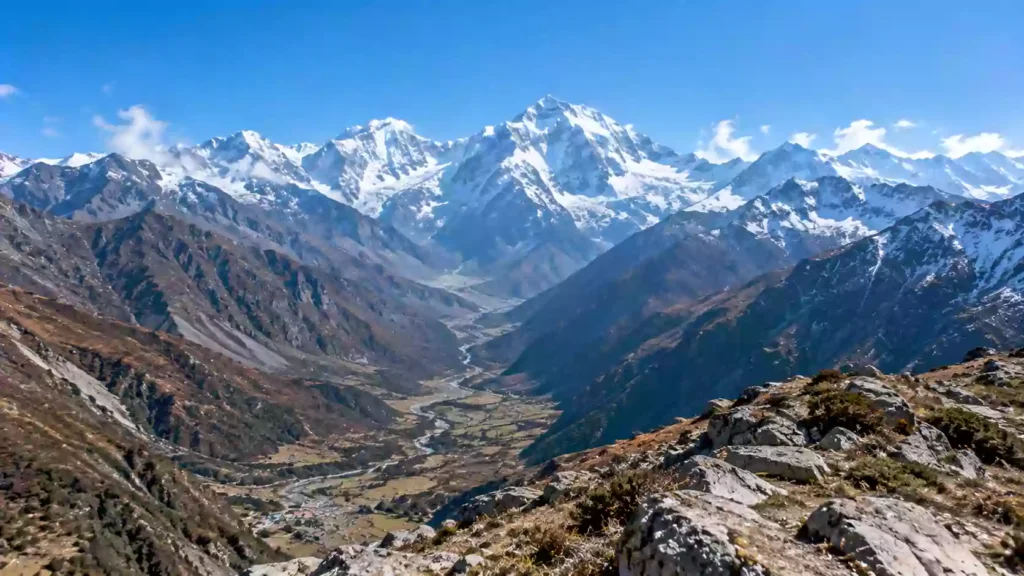
The main reason trekkers climb Kyanjin Ri is the mountain panorama.
As you gain elevation above Kyanjin Gompa, the upper Langtang Valley gradually opens below you. On a clear day, the viewpoint provides impressive views toward Langtang Lirung and other peaks of the Langtang Himal, as well as glaciers and high alpine terrain.
The scenery changes considerably during the climb. Lower sections are connected to the settlement and surrounding slopes, while the upper trail becomes more exposed and rocky.
What Is the Best Time for Kyanjin Ri Hiking?
The best seasons for Kyanjin Ri are generally spring and autumn, particularly March to May and October to November. Nepal Tourism Board identifies these periods as favorable for the Langtang region.
Spring: March to May
Spring brings relatively stable trekking conditions and blooming rhododendrons at lower elevations. As you climb higher, the landscape becomes increasingly alpine.
Autumn: October to November
Autumn usually offers good visibility after the monsoon. Mountain views can be excellent, although mornings and evenings become increasingly cold later in the season.
Winter
Snow and freezing temperatures can make the upper trail more difficult. Conditions should be checked locally before attempting the hike.
Monsoon
June to September brings rain, cloud and potentially difficult road and trail conditions. Visibility can also be poor.
What Should You Pack for Kyanjin Ri?
You do not need an expedition-style equipment list, but you should be prepared for high-altitude conditions.
Recommended gear
- Sturdy trekking boots
- Trekking poles
- Warm insulating layer
- Waterproof shell jacket
- Gloves and warm hat
- Sunglasses
- Sunscreen and lip balm
- Reusable water bottle
- Water purification method
- Small first-aid kit
- Headlamp for an early start
- Snacks and energy food
- Phone or camera with spare battery/power bank
The upper trail can be windy and exposed, so lightweight clothing suitable for lower elevations may not be enough at the summit.
Kyanjin Ri vs Tserko Ri: Which Should You Hike?
Kyanjin Ri is not the only high viewpoint from Kyanjin Gompa. Tserko Ri is another popular option and reaches a higher elevation.
| Feature | Kyanjin Ri | Tserko Ri |
|---|---|---|
| Approx. Altitude | 4,773 m | Around 5,000 m |
| Starting Point | Kyanjin Gompa | Kyanjin Gompa |
| Difficulty | Moderate to challenging | More demanding |
| Typical Duration | 3–5 hours | Longer full-day hike |
| Main Advantage | Shorter high viewpoint | Higher summit and wider panorama |
| Best For | Trekkers wanting a shorter climb | Fit, well-acclimatized trekkers |
The choice should depend on your acclimatization, weather, available time and physical condition, rather than simply choosing the higher mountain.
If you have already completed several demanding trekking days, the shorter Kyanjin Ri option may be more appropriate. If you’re drawn to shorter, viewpoint-focused hikes like this one generally, our short treks in Nepal roundup covers similar day-hike-friendly routes around the country.
Permits and Guide Requirements
Kyanjin Ri is reached as part of the Langtang trekking route, so trekkers should plan for the permits and requirements applying to the Langtang region rather than treating it as an isolated local hill hike.
Nepal Tourism Board currently lists the Langtang Trek among routes where trekkers must be accompanied by a licensed trekking guide and carry an agency-issued TIMS card.
A Langtang National Park entry permit is also required. The Nepal Tourism Board currently lists the Langtang National Park entry fee at NPR 1,500 for SAARC nationals and NPR 3,000 for other foreign nationals, with children under 10 listed as free.
Because regulations and fees can change, verify the latest requirements before departure.
Practical Tips for a Better Kyanjin Ri Hike
- Start early. Morning conditions often provide better visibility and cooler temperatures.
- Walk slowly. Do not try to maintain your low-altitude walking pace.
- Take regular breaks. Short rests are better than exhausting yourself early.
- Check the weather. Clouds can reduce the value of the climb considerably.
- Carry enough water. There are limited opportunities to refill on the upper trail.
- Listen to your guide. Local trail and weather knowledge matters.
- Turn around if necessary. A summit is optional; getting down safely is not.
- Keep your camera ready. The views improve dramatically as you climb.
Is Kyanjin Ri Worth Adding to the Langtang Trek?
For trekkers who are properly acclimatized and have suitable weather, Kyanjin Ri adds a valuable high-altitude viewpoint to the Langtang Valley Trek without requiring a separate multi-day expedition.
Its main attraction is the combination of accessibility and altitude. You can climb from Kyanjin Gompa, return to the same lodge, and continue your Langtang itinerary afterward.
However, the hike should not be described as an “easy viewpoint walk.” The approximately 900-metre ascent to 4,773 metres can be strenuous, particularly for trekkers who have not adjusted well to altitude. If a gentler pace across a different region appeals to you instead, our Nepal walking holidays guide covers lower-altitude alternatives.
If you want to experience the Langtang region but have limited trekking time, start with our Langtang Himal Trekking guide and then decide whether Kyanjin Ri fits your itinerary.
Frequently Asked Questions About Langtang Kyanjin Ri Hiking
How high is Kyanjin Ri?
Kyanjin Ri is approximately 4,773 metres (15,659 feet) above sea level. It rises around 900 metres above Kyanjin Gompa, which sits at approximately 3,870 metres. Although the hike is relatively short, the steep elevation gain at high altitude makes it physically demanding.
How long does it take to hike Kyanjin Ri?
Most trekkers should allow approximately 3–5 hours for the round trip from Kyanjin Gompa. Faster hikers may finish sooner, while slower hikers may need additional time for rest, altitude adjustment, and photography. Snow, weather, and individual fitness can also affect the walking time.
Is Kyanjin Ri difficult?
Kyanjin Ri is generally considered moderate to challenging. The trail does not normally require technical climbing, but it is steep and reaches approximately 4,773 metres. The biggest challenge is the combination of sustained elevation gain and thin air. Good acclimatization is more important than simply being physically fit.
Do I need a guide for Kyanjin Ri?
If you are reaching Kyanjin Ri as part of the Langtang Trek, current Nepal Tourism Board guidance lists the Langtang Trek among routes requiring a licensed trekking guide and agency-issued TIMS card. You should therefore arrange the trek through a registered trekking agency and confirm current requirements before departure.
What is the best month to hike Kyanjin Ri?
March to May and October to November are generally the strongest periods for trekking in the Langtang region. These months usually provide better conditions and mountain visibility than the monsoon period. Winter can bring snow and very cold conditions at higher elevations, so current trail conditions should be checked before hiking.
Is Kyanjin Ri harder than Tserko Ri?
Tserko Ri is higher and generally requires a longer, more demanding climb, while Kyanjin Ri is a shorter option from Kyanjin Gompa. The better choice depends on your acclimatization, weather, fitness and available time. Neither viewpoint should be attempted simply because it is the higher summit.
Plan Your Langtang Kyanjin Ri Hiking Adventure
Langtang Kyanjin Ri Hiking combines a demanding high-altitude climb with some of the most impressive scenery in the Langtang Valley. The route is short enough to fit naturally into a Langtang itinerary, yet high enough to provide a genuine Himalayan summit experience.
The key is preparation. Allow enough time to acclimatize at Kyanjin Gompa, start early, carry appropriate clothing and water, and make decisions based on weather and how your body feels at altitude.
For the complete route, cultural highlights and itinerary planning, explore our Langtang Himal Trekking guide.
Ready to Explore Kyanjin Ri?
Plan your Langtang adventure with local trekking support, practical route advice and an itinerary designed around your pace and acclimatization.