


Kala Patthar is the brown, rocky hump that rises behind Gorak Shep at the head of the Khumbu Valley, and it is where most people get the Everest photo they came for. From the prayer flags on top, at roughly 5,644 m (18,519 ft), you look straight across the Khumbu Glacier at the black summit pyramid of Everest, with Nuptse, Changtse and the tip of Lhotse lined up beside it. Everest Base Camp sits right under the mountain, so the summit is hidden from there. Kala Patthar is where you finally see the whole thing.
This guide covers what you need to know before you climb it: the real height (there are two numbers going around), how long the hike from Gorak Shep takes, whether sunrise or sunset is worth the effort, how hard it feels at that altitude, what to wear at four in the morning, and how to fit it into your Everest itinerary without wearing yourself out.
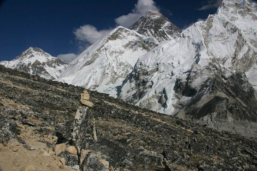
Kala Patthar at a glance
| Height | About 5,644 m (18,519 ft) at the prayer-flag viewpoint; many maps list 5,545 m |
| Meaning | “Black rock” in Nepali |
| Location | South ridge of Pumori, above Gorak Shep, Sagarmatha National Park, Solukhumbu |
| Starting point | Gorak Shep (about 5,164 m), the last lodge stop before Base Camp |
| Height gain | Roughly 400 to 480 m |
| Time needed | 1.5 to 3 hours up, about 1 hour down |
| Difficulty | Non-technical, but hard work because of the altitude and cold |
| Best seasons | Late September to November, and March to May |
| Permits | Covered by your normal Everest trekking permits, no extra fee |
How high is Kala Patthar? Why do you see two numbers
Ask three trekking companies how high Kala Patthar is, and you may get three answers. For example, older maps and many signboards give 5,545 m (18,192 ft). However, GPS readings taken at the prayer-flag point in 2006 and 2008 came out at about 5,643 to 5,644 m, and that is the figure most guides now use.
This is because Kala Patthar is not really a separate mountain. It is a bump on the long south ridge that runs down from Pumori (7,161 m), with almost no prominence of its own. The spot trekkers climb to, the one covered in prayer flags, is simply a high point on that ridge. Whichever number you go with, it is the highest place most people reach in Nepal without a climbing permit, and it sits around 280 m above Everest Base Camp (5,364 m).
Where Kala Patthar sits on the Everest Base Camp route
You reach Kala Patthar at the very end of the classic trail. Most people fly into Lukla, walk up through Phakding to Namche Bazaar, then carry on via Tengboche, Dingboche and Lobuche. From Lobuche it is a two- to three-hour walk along the lateral moraine of the Khumbu Glacier to Gorak Shep.
Gorak Shep is a small cluster of lodges on the edge of a dry, sandy lakebed. It is the last place to sleep before Base Camp, and Kala Patthar rises directly behind it, with the white pyramid of Pumori above. Base Camp is another two to three hours up the glacier in the other direction, which is why most itineraries spend a night here and split the two side trips across an afternoon and the following morning.
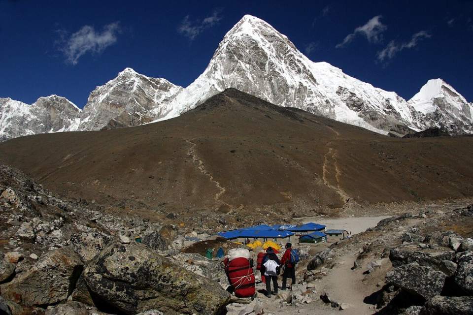
The hike from Gorak Shep, step by step
On a map, it is barely two kilometres each way. Even so, at over 5,000 m it feels a lot longer. Here is what to expect.
1. Crossing the lakebed (10 to 15 minutes). First, you leave the lodges and walk across the flat sand of the old lake. In the dark, this is the easiest part, and a good time to settle your breathing before the climb starts.
2. The switchbacks (about an hour). The trail then zigzags steeply up a slope of dry grass, dust, and loose stones. This is where people find out how they really feel. Take short steps, breathe on every step, and stop for a minute every 20 or 30 paces rather than charging and collapsing. Our guides often tell trekkers to walk at a pace where they could still hum a song.
3. The shoulder (around 5,450 to 5,500 m). The slope eases onto a broad shoulder with a few cairns. As a result, a lot of people mistake this for the top. It isn’t, but the view of Everest is already excellent, and if you are struggling, it is a perfectly good place to stop.
4. The final rocks (20 to 40 minutes). Finally, the last stretch follows the ridge over large boulders to the prayer flags. You may want to use your hands in places. After fresh snow or on frosty mornings, the rocks can be slippery, so take your time and keep away from the steep western side.
5. The descent (45 to 75 minutes). You come down the same way. Unfortunately, it is hard on the knees, and the loose gravel on the switchbacks catches a lot of tired people out. Trekking poles help a great deal.
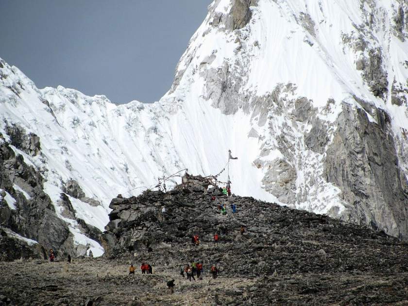
What you can see from the top
The view is the whole point, so it helps to know what you are looking at.
- Everest (8,849 m): the dark summit pyramid straight ahead, rising above the long ridge of Nuptse. Unlike at Base Camp, you can see the actual summit, often with a plume of snow blowing off it.
- Nuptse (7,861 m): the huge fluted wall right in front of Everest that dominates the skyline.
- Lhotse (8,516 m): only the top peeks out behind the Nuptse ridge, so look carefully.
- Changtse (7,543 m): on the Tibetan side, to the left of Everest, across the Lho La pass.
- Khumbutse and Lingtren: the peaks along the Nepal and Tibet border at the head of the glacier.
- Pumori (7,161 m): directly behind you. Turn around; it is enormous at this distance.
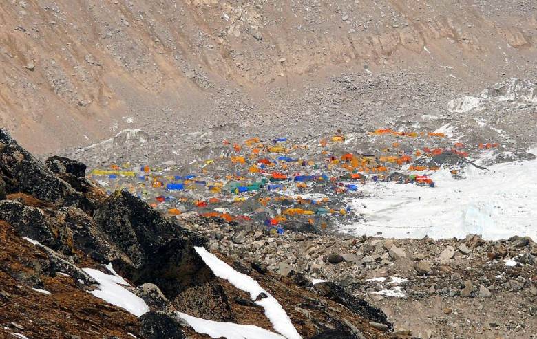
- The Khumbu Glacier and Icefall: the grey, rubble-covered glacier below you and the jumbled icefall climbers use to start their Everest climb. In spring you can pick out the yellow and orange tents of Base Camp.
- Looking south: Ama Dablam, Thamserku, Kangtega, Taboche and Cholatse, the peaks you have been walking past for the last week.
Sunrise or sunset: which is better?
This is the question every group argues about at Gorak Shep. Both work. However, they give you quite different things.
| Sunrise climb | Sunset climb | |
| Light on Everest | The sun rises behind Everest, so the mountain is backlit with a glowing outline | The sun is behind you, lighting the faces of Everest and Nuptse in warm gold |
| Weather odds | Usually the clearest skies of the day | Clouds often build in the afternoon, especially in spring |
| Cold | Bitter. Often minus 10 to minus 20°C with wind chill in autumn | Cold, but easier until the sun drops |
| Descent | In daylight | Mostly in the dark with a headtorch |
Our honest view: if your plan is Base Camp in the afternoon, go up Kala Patthar the next morning. The weather is more reliable, and you descend in daylight. You don’t need to be on top at the exact moment of sunrise either. Leaving around 4:30 to 5:00 a.m. and reaching the top 30 to 60 minutes after sunrise gives you full sun on the peaks and slightly warmer fingers. If you are a keen photographer, travelling in the settled weather of October or November, and feeling strong, the late afternoon light on Everest is the more beautiful option.
How hard is the Kala Patthar hike?
Technically, it is just a steep walk. However, what makes it tough is everything around it. At around 5,500 m, the air holds roughly half the oxygen you get at sea level. Most people sleep badly at Gorak Shep; you start in the dark and cold, and you have already walked for nine or ten days to get there. Plenty of fit people find the last 200 m of Kala Patthar the hardest walk of their lives.
Good preparation at home makes a real difference, so have a look at our Everest Base Camp training plan if you are a few months out. On the trail, the most important thing is proper acclimatization days in Namche and Dingboche.
Know when not to go. If you have a headache that won’t go away with rest and water, are vomiting, feel breathless while resting, or are unsteady on your feet or confused, do not climb. Those are signs of altitude sickness getting worse, and the only fix is going down. Our guide to preventing altitude sickness on the Everest Base Camp trek explains the symptoms in more detail. It is also smart to agree on a turnaround time before you leave Gorak Shep. The shoulder is a fine place to finish.
Fitting the climb into your Everest itinerary
There are three common ways to do it.
The classic plan. Walk from Lobuche to Gorak Shep in the morning, drop your bags, and visit Base Camp in the afternoon. Climb Kala Patthar at dawn the next day, come back for breakfast, and descend to Pheriche or Dingboche. It is a big couple of days, but it gets you down to thinner air quickly. Most of our Everest Base Camp Trek departures follow this pattern.
The sunset plan. Arrive at Gorak Shep, rest over lunch, and climb Kala Patthar in the afternoon for sunset. Visit Base Camp the next morning and then start down. This suits photographers and people who would rather not get up at 4 a.m.
The longer loop. If you want more than one big viewpoint, combine Kala Patthar with Gokyo Ri by crossing the Cho La Pass. Our Gokyo Cho La Pass Trek and the full Everest High Passes Trek both include it. Not sure which valley suits you? Read our comparison of EBC vs Gokyo Lakes.
Short on time? Many Everest helicopter tours land briefly at or near Kala Patthar for photos. Because you arrive without acclimatizing, these stops are kept to a few minutes for safety.
What to wear and carry for the climb
A sunrise climb is the coldest few hours of the whole trek. Pack your daypack the night before so you are not hunting for gloves in the dark.
- A warm down jacket, worn from the start, not carried
- Insulated gloves with thin liner gloves underneath for using your camera
- Warm hat and a buff or neck gaiter for the wind
- Thermal base layers top and bottom, plus a fleece
- Head torch with spare batteries
- About a litre of hot water in an insulated bottle, since normal bottles can freeze
- Snacks you can eat with gloves on, such as chocolate, nuts or energy bars
- Sunglasses and sunscreen for the walk down
- Trekking poles
- Microspikes in winter or after snowfall
Keep your phone and camera batteries in an inside pocket, because cold drains them fast. In fact, a dead battery on the summit is a very common disappointment. For a full list, see our Nepal trekking equipment guide.
Photography tips for the summit
- A wide-angle lens or phone setting captures the full sweep from Pumori to Nuptse. A short telephoto lets you isolate the Everest summit and its snow plume.
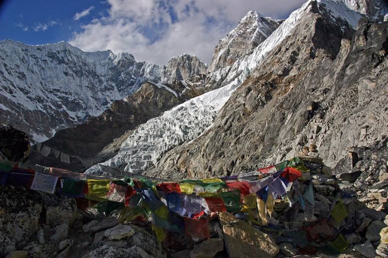
- Use the prayer flags, cairns, and the glacier as foreground. They give a sense of scale that a photo of peaks alone never does.
- Take photos from the shoulder as well as the top. The angle is slightly different, and it is often less crowded.
- Don’t stand near the edge for a selfie. The drop on the far side is steep, and the rocks are loose.
- Put the camera away for a few minutes and just look. People say this every time, and they are right.
Permits, costs and guides
There is no separate permit for Kala Patthar. It is covered by the permits you already need for the Everest region: the Sagarmatha National Park entry permit (NPR 3,000 plus VAT for foreign visitors) and the Khumbu Pasang Lhamu Rural Municipality permit (reported at NPR 3,000 in 2026). Fees do change, so check our Nepal trekking permit guide for the latest figures before you travel.
Gorak Shep is the most expensive stop on the trail because everything is carried up by porters and yaks. So budget a little more for meals, hot water and charging here, and bring enough cash from Kathmandu or Namche. Our posts on how much cash to carry on a Nepal trek and the total cost of the Everest Base Camp trek break the numbers down.
The Everest region has so far continued to allow independent trekkers, but rules in Nepal change often. Either way, a guide is worth having on this particular morning. Route finding across the lakebed and up the switchbacks in the dark, judging how someone is coping with the altitude, and knowing when to turn back are exactly what an experienced guide is for. See our breakdown of guide and porter costs in Nepal.
Plan your climb with a local team
Our guides have climbed Kala Patthar at every hour and in every season. They know when to leave Gorak Shep for the best light, which lodges are warmest, and how to pace the last few days so you still have energy left for the summit. Take a look at our Everest Base Camp Trek itinerary, browse all our Everest region treks, or contact our team to plan your own dates.
Frequently asked questions about Kala Patthar
How high is Kala Patthar?
The prayer-flag viewpoint trekkers climb to is about 5,644 m (18,519 ft), based on GPS readings. Many maps still show 5,545 m (18,192 ft). Either way, it is higher than Everest Base Camp.
Can you see Everest from Kala Patthar?
Yes. In fact, Kala Patthar is one of the best places to see Everest, including its summit, which is hidden from Base Camp itself. You also see Nuptse, Changtse, the top of Lhotse, and the Khumbu Icefall.
How long does it take to climb Kala Patthar from Gorak Shep?
Most trekkers take 1.5 to 3 hours to reach the top and about an hour to come down. Overall, allow 3 to 4 hours for the round trip, including time at the top.
Is it higher than Everest Base Camp?
Yes, by roughly 280 m. Base Camp is at about 5,364 m, while the Kala Patthar viewpoint is about 5,644 m.
Do I need a separate permit?
No. Your Sagarmatha National Park permit and Khumbu Pasang Lhamu Rural Municipality permit cover the whole trail, including Kala Patthar.
Can beginners do this climb?
Yes, if they are reasonably fit and well acclimatized. No climbing skills are needed. However, beginners should allow enough rest days on the way up and be ready to turn back if altitude symptoms appear.
What is the best month to climb Kala Patthar?
October and November usually give the clearest views and most stable weather. April and May are also good, with milder temperatures and the Everest Base Camp tents visible below. December to February can be crystal clear but very cold, while June to August is often cloudy because of the monsoon.